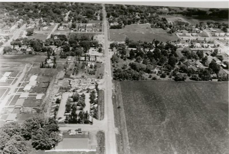
Aerial, taken June 1, 1959 at 2 p.m.for the Iowa Highway Commission, looking east, with Lincoln Way in the vertical center beginning at a point some blocks west of Franklin Avenue (the north-south street in the horizontal center of the photograph). This was part of a series of aerial photographs which were taken in preparation for the widening of Highway 30 (Lincoln Way) to four lanes. The large field in the bottom right quadrant of the photo is where a shopping center, at 3800 West Lincoln Way, would later be located. The Ames Trailer Park (3621 Lincoln Way) can be seen in the lower left quadrant, north of Lincoln Way. Welch Junior High School's playing field can be seen in the upper right quadrant.
Citation: 206.1171.5
Year: 1959